Advancements in unmanned aerial vehicles (UAVs), commonly known as agricultural drones, are transforming modern farming by enabling farmers to monitor crops with unprecedented precision and speed. These aerial systems, equipped with sophisticated sensors and imaging tools, have quickly become a cornerstone of the sustainability-driven shift in the global agricultural market. By capturing detailed insights into crop health, soil conditions, and pest pressures, agri drones empower growers to make data-driven decisions that boost efficiency and maximize yield while reducing environmental impact.
The Rise of Precision Agriculture and Drone Technology
Precision agriculture emerged as a response to the growing demand for food production and the need to steward natural resources responsibly. Traditional methods relied heavily on manual scouting and uniform application of inputs such as water, fertilizers, and pesticides. Today’s farmers leverage cutting-edge technologies—satellites, ground sensors, and most notably, drones—to tailor their management practices at a micro scale. As drone costs have declined and capabilities have soared, these machines are now widely adopted across continents, from large grain farms in North America to smallholder estates in Africa and Asia.
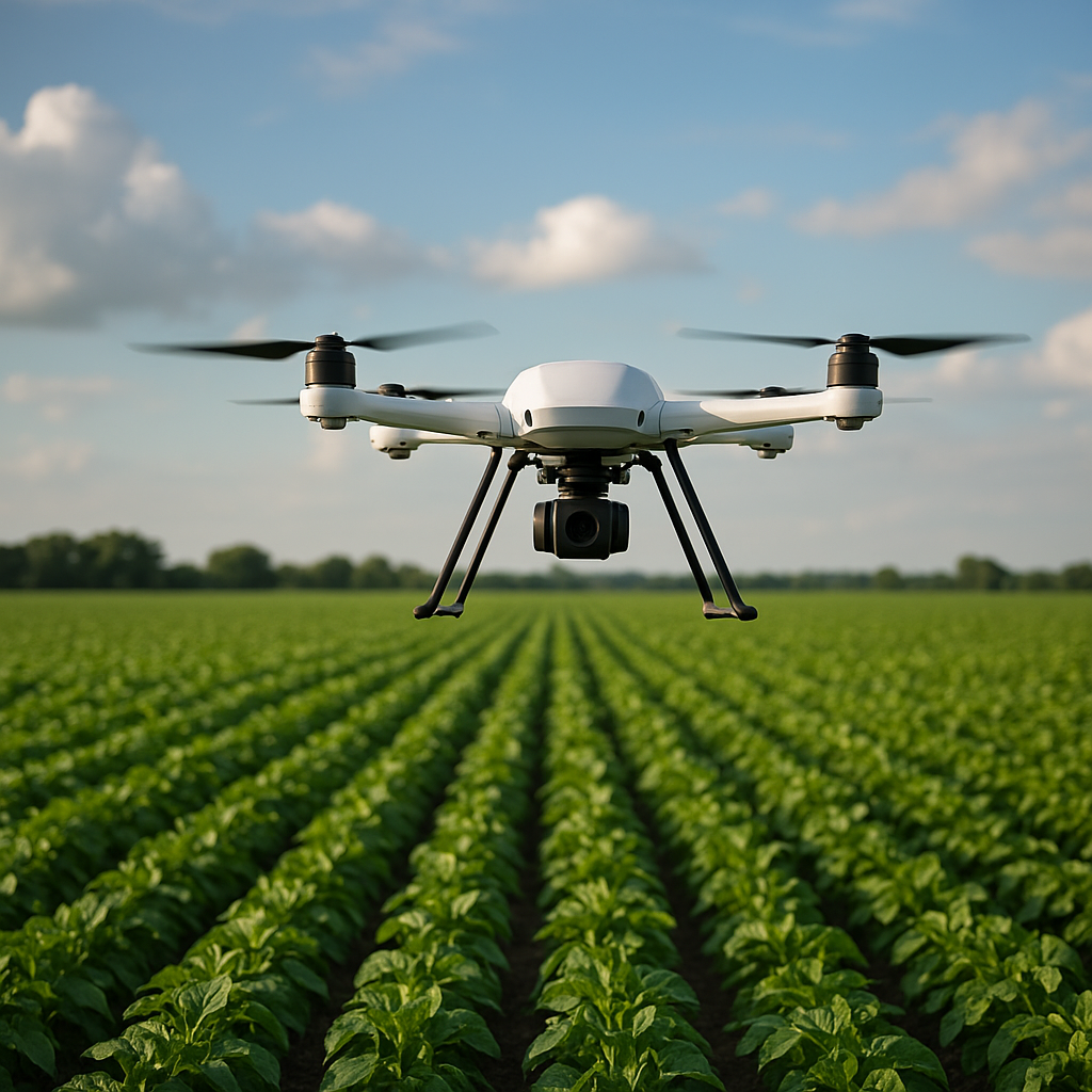
With payload capacities ranging from lightweight multispectral cameras to variable-rate sprayers, drones facilitate a range of operations. High-resolution imagery can reveal early signs of stress, nutrient deficiencies, or disease outbreaks before they become visible to the naked eye. This early detection is critical: timely interventions can save large swaths of crop, preserve valuable inputs, and ultimately enhance farm profitability. Agri drones also reduce labor requirements, enabling remote monitoring of vast tracts of land in a fraction of the time needed for ground surveys.
Core Benefits of Drones in Crop Monitoring
Real-Time Data Collection
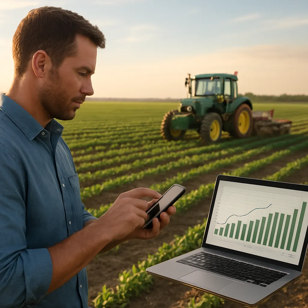
One of the most compelling advantages of drones is their ability to deliver real-time data. Equipped with GPS and advanced autopilot systems, drones conduct pre-programmed flight missions with millimeter-level accuracy. They repeatedly scan fields on demand, providing updated maps of crop vigor and soil moisture. This continuous stream of information allows agronomists to respond swiftly to dynamic field conditions and adjust management strategies accordingly.
Enhanced Crop Health Assessment
Multispectral and hyperspectral sensors measure reflected light across various wavelengths, enabling detection of subtle changes in plant physiology. By calculating vegetation indices such as NDVI (Normalized Difference Vegetation Index) and EVI (Enhanced Vegetation Index), farmers can pinpoint areas of stress that call for immediate attention. These indicators help differentiate between water stress, nutrient imbalances, and pest infestations, guiding targeted applications and minimizing waste.
Optimized Resource Use
Through precision mapping, drones identify zones requiring varied rates of fertilizer or pesticide application, reducing over-application and runoff. Variable-rate technology integrated with drone data supports precise input distribution, cutting costs and environmental footprint. Studies indicate that variable-rate nutrient management can reduce fertilizer use by up to 30%, translating to significant savings and lowered risk of waterway contamination.
Key Technologies and Their Roles
Crop monitoring with drones relies on a synergy of hardware and software innovations. High-resolution RGB cameras capture standard visual imagery, while multispectral and thermal cameras record data beyond the visible spectrum. Thermal imaging, for instance, reveals plant canopy temperatures—an indirect measure of water stress and transpiration rates. By flying during early morning or late afternoon, when temperature gradients are most pronounced, drones produce thermal maps that help optimize irrigation schedules and detect malfunctioning sprinklers.
On the software side, artificial intelligence and machine learning algorithms process vast image datasets to classify crop conditions, forecast disease spread, and generate actionable recommendations. Cloud-based platforms offer farmers an intuitive interface to view maps, run analytics, and export prescriptions for automated variable-rate equipment. Many platforms incorporate predictive modeling, allowing growers to simulate different management scenarios and evaluate potential outcomes on yield and resource use.
Furthermore, drone fleets are integrated with Internet of Things (IoT) devices, such as soil moisture probes and weather stations, creating a comprehensive monitoring network. This interconnected system fosters holistic farm management, as data from ground sensors calibrates aerial observations for greater accuracy. Through advanced analytics, farmers gain a complete picture of field variability, enabling them to fine-tune irrigation, fertilization, and pest control strategies down to individual rows or plants.
Integration into the Global Agricultural Market
As the need to feed a projected 10 billion people by 2050 intensifies, agri drones are increasingly recognized as a vital tool in the global food supply chain. Large agribusinesses view drone programs as a way to safeguard their investments and ensure consistent output, while smallholders in developing regions gain access to precision tools once beyond their reach. Governments and international organizations support drone adoption through subsidies, training programs, and regulatory frameworks that define safe flight corridors and data privacy standards.
Commercial service providers have emerged, offering drone surveying as a subscription-based model. Farmers without the capital to purchase and maintain UAV fleets can rent flights by the hour or by acreage. This democratization of technology accelerates adoption, as producers can scale services to match their budgets and seasonal needs. In parallel, academic institutions and research centers partner with industry to validate best practices and refine sensor calibrations for different crop types and climates.
Export markets for drone hardware and software are robust. Manufacturers in North America, Europe, and Asia compete to supply versatile platforms tailored to local cropping systems. Software developers are expanding multilingual interfaces and region-specific algorithms to address unique agronomic challenges. As a result, the global agricultural drone market is forecast to reach multi-billion-dollar valuation within the next five years, driven by demand for higher efficiency and sustainable output.
Challenges and Future Prospects
Despite rapid growth, drone integration faces hurdles. Regulatory compliance remains a patchwork across countries, with varying requirements for pilot certification, flight altitude limits, and data ownership. Connectivity constraints in remote regions can impede real-time data transfer, although advances in satellite IoT and mesh networking promise improved coverage. Additionally, interpreting complex multispectral data requires skilled personnel, creating a need for robust training and user-friendly analytics platforms.
Looking ahead, the convergence of drone technology with robotics and automation opens new possibilities. Autonomous ground vehicles may work in tandem with aerial drones, performing precision weeding or fertility management based on drone-derived maps. Swarm drone operations, coordinated through AI, could survey large areas in a fraction of the time, further enhancing productivity. Innovations in sensor miniaturization and battery life will extend flight durations, while new payloads—such as LIDAR scanners—will add depth to three-dimensional field mapping.
Ultimately, the continual evolution of agri drones reflects a broader trend toward data-driven innovation in agriculture. By empowering farmers with near-instant insights and enabling precise interventions at scale, these aerial tools are shaping a future where resource use is optimized, environmental impact is minimized, and global food security is strengthened.