Satellite-based observations have become a cornerstone in modern agriculture, providing unprecedented insights into crop health, soil moisture, and environmental conditions. By harnessing data streams from orbiting platforms, farmers, agribusinesses, and policymakers can achieve precise management of resources, enhance predictive models, and ultimately drive higher productivity. This article delves into the multifaceted ways in which satellite data bolsters yield optimization, explores its commercial implications in the global market, and highlights emerging trends shaping the future of agri-tech.
Emerging Role of Satellite Imagery in Agriculture
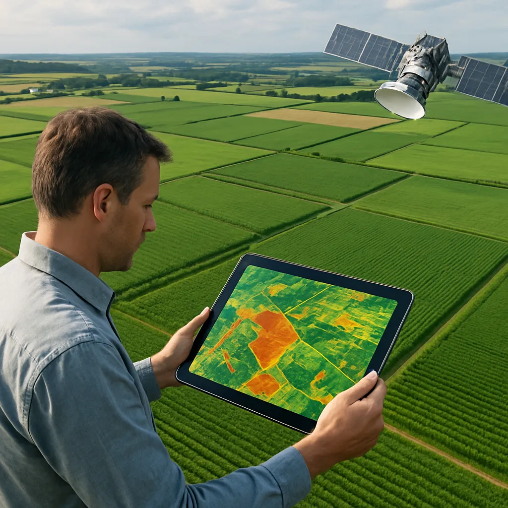
The integration of satellite imagery into farming practices has revolutionized traditional approaches. High-frequency, high-resolution sensors aboard satellites capture electromagnetic signatures that reveal variations in plant vigor, moisture stress, and nutrient deficiencies. When processed through advanced analytics platforms, these spectral readings translate into actionable intelligence for field managers. Unlike ground-based measurements, satellites offer comprehensive coverage across vast tracts of land, ensuring no blind spots in monitoring efforts.
Key advantages include:
- geospatial mapping: Seamlessly combining positional data with soil and weather layers.
- monitoring growth cycles: Tracking phenological stages from germination to harvest.
- Temporal consistency: Repeated overpasses that capture crop dynamics at regular intervals.
- Cost efficiency: Scaling insights without deploying extensive in-field equipment.
By harnessing multispectral and hyperspectral data, agronomists can tailor interventions such as targeted irrigation, fertilization, and pest control. This dynamic approach contrasts sharply with one-size-fits-all strategies, yielding more precise resource allocation and reducing environmental footprints.
Applications in Precision Farming and Yield Management
Precision farming thrives on the ability to pinpoint small-scale variations within fields. Satellite-derived indices, such as NDVI (Normalized Difference Vegetation Index) and NDWI (Normalized Difference Water Index), act as proxies for plant health and moisture availability. Coupled with machine learning algorithms, these indices feed into predictive models that enhance crop forecasting and inform real-time adjustments.
Variable Rate Technology Integration
Implementing Variable Rate Technology (VRT) hinges on accurate spatial data layers. Zones of differing productivity are delineated through satellite analyses, enabling equipment to apply inputs at site-specific rates. Farmers can thus:
- Optimize fertilizer distribution to avoid over-application.
- Reduce water usage by irrigating only stressed areas.
- Minimize pesticide runoff through targeted spraying.
This synchronization between satellite insights and on-ground machinery ensures each plant receives exactly what it needs for maximum yield.
Stress and Disease Detection
Early identification of stressors—whether from drought, disease, or nutrient imbalances—allows for proactive measures that safeguard crop stands. Satellite time series data, when combined with meteorological forecasts, offer real-time alerts of emerging hotspots, reducing response times and limiting yield losses.
Impact on the Global Agriculture Market
On a macroeconomic level, satellite data drives market transparency, risk management, and supply chain optimization. Governments and commodity traders utilize remote-sensing intelligence to gauge harvest prospects, adjust import-export policies, and stabilize price volatility. For instance, baseline yield projections derived from satellite observations feed into global agricultural indices, guiding investment decisions and hedging strategies.
Multinational agribusinesses leverage these insights to:
- Forecast demand for fertilizers and agrochemicals.
- Plan logistics for grain shipments based on harvest timelines.
- Assess land-use changes and compliance with sustainability commitments.
The democratization of satellite services has also lowered barriers for smallholders in emerging economies. Mobile applications now deliver tailored advisories based on geospatial analysis, boosting farm-level profitability and bridging the technology gap. Such inclusivity strengthens food security by enabling data-driven decisions even in resource-constrained settings.
Challenges and Future Directions
Despite the transformative potential of satellite data, several hurdles persist. Cloud cover and atmospheric disturbances can obscure optical signals, necessitating complementary radar or thermal sources. Integrating disparate datasets—satellite, drone, IoT sensors—requires robust data fusion frameworks capable of handling varied resolutions and formats.
Key challenges include:
- Data latency: Ensuring timely delivery of processed insights.
- Scalability: Managing petabytes of imagery while maintaining performance.
- Accessibility: Providing user-friendly interfaces for non-technical stakeholders.
Looking ahead, the convergence of artificial intelligence, edge computing, and next-gen satellite constellations promises even greater refinement. Swarms of nanosatellites will offer hourly revisits, fueling continuous monitoring and more precise decision-making. Advances in hyperspectral sensing will uncover subtle biochemical changes in crops, pushing the boundaries of pre-symptomatic detection. Ultimately, these innovations will reinforce sustainable intensification strategies, striving to meet global food demands with minimal environmental impact.
As the agri-tech ecosystem evolves, the synergy between satellite data and on-farm practices will remain a catalyst for enhanced optimization and resource stewardship, driving the next leap in agricultural productivity and ecosystem resilience. With strategic investments and collaborative frameworks, the full promise of space-enabled agronomy can be realized, empowering stakeholders across the value chain to thrive in an increasingly complex global market.